High tech against the blaze
A forest fire starts small. A spark, a glowing branch, dry vegetation. At first, there’s not much more than a little smoke, but just within that short time window the decision is made whether it's going to turn into a manageable mission for fire fighters or a wildfire that eats its way through hundreds of hectares of forest, cuts off roads, threatens homes, and forces people to flee. Currently, several regions around the world are experiencing again how quickly arid periods can produce safety issues as well as environmental and economic damage.
New technologies help detect emerging fires early and gain time in that way. Satellites scan the surface of the Earth searching for thermal irregularities. Cameras on masts and mountain peaks automatically search for smoke. Ground sensors analyze the air for typical fire gases. Drones fly over difficult to access slopes and, using thermal imaging cameras, make things visible that are hard to detect by human eyes. Not least, artificial intelligence helps convert such data not only into an idea of the fire but preferably into a prediction of its next move. The objective is not to fight fires in more spectacular ways but to track them down as early as possible.
Forest fires turn into datasets
The decisive innovation in this regard is not a single device but the interaction between many systems. On its website, the German Aerospace Center (DLR) describes that approach as a “combination of astronautics, aviation, AI, and security – from global detection to agile drone swarms to real-time support with data and maps for tactical local mission planning.”
The way that looks in practice became evident in May of 2016 in the mountainous south of Germany, more precisely at the Saurüsselkopf near Ruhpolding not far from the German-Austrian border. A fire in a mountain forest had spread to an area of 15 hectares (37 acres). Due to the complicated topography, large parts of the fire zone were hard to inspect from the ground. The DLR Center for Satellite-Based Crisis Information (ZKI) was consulted. The ZKI ultimately combined geo data, current satellite pictures, and high-resolution drone images into a so-called multi-modal situational picture that was updated daily and provided the mission control team of the Bavarian Red Cross (BRK) with the basis for coordinating some 300 responders.
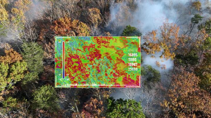
Especially valuable was the combination of aerial and thermal imaging. The BRK’s research drone – equipped with the DLR’s camera system MACS – scanned the area with a length of two kilometers (1.25 miles) and a width of one kilometer (0.6 miles) for hot spots that were invisible to the human eye. The data helped to systematically coordinate responders and material and to continuously monitor progress during the firefighting operations. “It was especially important that the data generated with our MACS system were usable directly in real-world operations without any additional integration effort,” said Ralf Berger from the DLR Institute for Space Research. BRK mission leader Dr. Felix Böhringer referred to a “real operational value for fighting fires.”
Forest fires in 2026 – the statistics
Detecting fires from space
With its FireBIRD mission, the DLR showed even years ago how specialized small satellites can observe fires from space. TET-1 and BIROS were equipped with highly sensitive infrared cameras. They were able to not only capture the position of a fire but also its intensity and the development of the fire front. BIROS, the second satellite of the mission, was a kind of digital fire magnifying glass. Its infrared system was able to capture temperatures between 300 and 1,300 degrees centigrade (570 and 2,370 degrees Fahrenheit). Even fire spots of just about ten square meters (108 square feet) were detectable from the orbit, according to DLR. On January 22, 2026, the satellite burned up in the Earth’s atmosphere after nearly ten years of service.
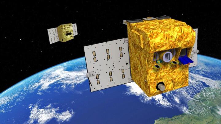
Today, the idea of commercial satellite constellations is under further development. In early May 2026, Greece deployed four satellites specifically developed for forest fire monitoring into orbit. They make up the “Hellenic Fire System” and are supposed to continuously monitor the entire national territory of Greece and provide real-time information about new sources of fire. Equipped with thermal infrared cameras, the satellites can detect hot spots of merely four by four meters (13 by 13 feet). The satellites were developed by Munich-based OroraTech together with the European Space Agency ESA. They’re special in that the data are fed directly into the Greek emergency structures to provide specific information to fire fighters on the ground as fast as possible. According to information released by the company, Greece is the first country to fully integrate its own satellite constellation into its national fire forest protection effort.
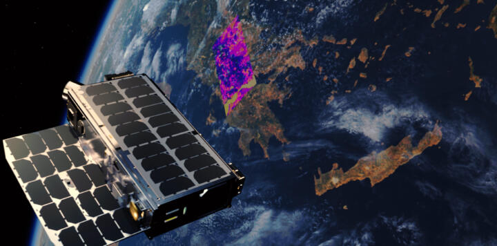
For Greece’s digital minister Dimitris Papastergiou, that marks a “big step forward in fighting forest fires.” The integration of orbit-based capabilities into the emergency systems, says Papastergiou, provides fire fighters with the tools to respond faster, act more effectively, and to protect lives, property, and the environment. That’s exactly the difference to a classic Earth observation satellite: It’s not just about seeing a fire on a map. The information where fire trucks, evacuations or other actions are decided is supposed to arrive within minutes.
However, the system is not yet fully ready for service. Initial pictures have already been supplied from space in June but complete readiness is supposed to be achieved only in September. The fire fighters are currently still being trained as well. That’s why even this state-of-the art technology wasn’t able to detect the most recent fires in Greece in time to limit their extent.
When sensors smell fires
Sometimes, though, high tech doesn’t even have to fly far. In the German Harz Mountains, the Hamburg-based company Breeze Technologies is testing a different idea: Sensors continuously analyze the air, searching for characteristic fire gases. The principle resembles a smoke detector, except that the objects of observation not only include smoke but also the chemical composition of the ambient air. An AI evaluates the measurements. “We do not measure only the smoke but also the gases that are produced in a fire,” says Breeze’s founder, Robert Heinecke, explaining the principle. Exactly that’s supposed to provide the sensors with a crucial time advantage: under certain circumstances, they may register a fire even before a visible smoke trail reaches a camera.
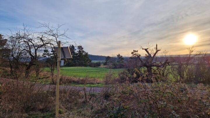
Since the beginning of 2023, as part of a model project, a total of 21 sensors were deployed, nine of them in the Harz National Park. Four in six fire events in the monitored area were detected and automatically reported, according to the company. At the same time, the project points out the limits of the methods: sensors must be positioned in ways that match the direction of the wind. In the case of two fires, the detection failed because the fire was outside the monitored area or the wind’s position was unfavorable, among other things.
That exactly is an important lesson taught by forest fire technology: No sensor is an oracle. A satellite’s performance may be restricted by clouds. A camera may mistake smoke for fog. A gas sensor needs the right direction of the wind. A drone has a limited period of flying. And AI is only as good as the data it works with. Consequently, the future lies less in the perfect sensor than in the combination.
California: AI is watching
How such a combination works on a large scale can be seen in California. The ALERTCalifornia program of the University of California San Diego by now operates more than 1,200 high-resolution, swiveling and zoomable cameras. They monitor particularly vulnerable regions around the clock, have night-vision capabilities, and can pivot by 360 degrees within about two minutes. In clear conditions, the cameras have a range of up to 60 miles per day and 120 miles at night, according to the operator.
The crucial component is the software: An AI jointly developed with the Californian fire department CAL FIRE analyzes the camera images for suspicious smoke developments. Since September 2023 the system has been available to all 21 CAL-FIRE emergency call centers. According to ALERTCalifornia, the AI detected more than 1,200 fires just in its first season – and in more than 30 percent of all cases was faster than an incoming 911 emergency call. When the system detects a potential fire, the responders receive information about its assumed location and can continue to observe the situation based on the camera images. That extends its usefulness beyond mere early detection. Incident commanders are provided with a continuous picture of how a fire is developing and can deploy resources in more targeted ways.
“The real-time ability to observe emerging incidents empowers our Emergency Command Centers to make critical decisions.”
CAL FIRE Director and Fire Chief Joe Tyler
But California is increasingly shifting the monitoring effort into outer space as well. FireSat, developed by Californian space company Muon Space in collaboration with the Earth Fire Alliance (EFA), a global non-profit coalition that aims to support fire departments around the world with real-time forest fire data, is designed specifically for the detection and monitoring of forest fires. The first three satellites began their service in July 2026, marking the kickoff for a far more ambitious goal: by 2030, a constellation of more than 50 satellites is planned to capture the entire Earth in 20-minute intervals.
Australia, too, is increasingly relying on a mix of cameras, drones, and satellites. In New South Wales (NSW), high-resolution cameras detected nearly 4,000 fires last year, according to the NSW government. AI-assisted cameras, thermal imaging drones, and additional satellite communication are supposed to help responders detect fires earlier and keep track of them even in remote regions.
Role of fire fighters is changing
The reason is that the arguably most challenging task begins after detection. Fire doesn’t move like a static dot on a map. The wind, temperature, terrain, vegetation, and humidity change a fire’s speed and direction. Research groups are already working on interlinking fire histories, weather data, topography, and vegetation data from which AI models can project various possible developments of a fire.
That also means that the role of fire fighters is changing. They’re not just getting another technical tool to work with. They’re receiving information before arriving at the scene: Where is the fire? How big is it? Where are the hot spots? What’s the direction of the fire front? What roads are accessible? What infrastructure might be endangered? Consequently, “there’s a fire” increasingly turns into much more precise information: what’s currently happening there – and what’s going to happen next more than likely?
High tech, however, can provide only part of the answers
As precise as satellites, sensors, and AI may become, they, alone, cannot solve the fundamental problem, warns ETH research scientist Christine Eriksen on the website of the Swiss university, referring to the interaction of a hotter and drier climate, increasing tree death, changed use of land, and a decades-long excessively cautious firefighting policy. In many regions, says Eriksen, farmers and forest rangers were no longer allowed to use controlled, low-intensity fires. That results in dry material collecting in undergrowth areas, serving as fuel for the next big fire: “Together with high temperatures and heavy winds, that makes for extremely dangerous conditions.”
That’s why Europe would need to learn to distinguish between good fire and bad fire, “We must create landscapes that are more resistant to fire and abandon the idea that every fire is harmful,” says Eriksen. Controlled fires can reduce dry combustible material and thus make landscapes more resilient. She deliberately makes a provocative proposition: “Would you rather put up with some smoke during a controlled fire for a few days or with massive amounts of smoke due to a catastrophic forest fire for weeks or months?”
So, the difference lies not only in the blaze, but in its intensity, its context, and in controlling it. “Good fire helps preserve healthy ecosystems – also in Europe,” says Eriksen. “Bad fire,” on the other hand describes the catastrophic forest fire spreading in uncontrolled ways. Therefore, living with fire means “understanding the role of fire in the landscape and developing a conscious way of dealing with it,” instead of assuming that it’s possible to fully control or eliminate it, says Eriksen.